MORGAN CITY, La. — Hurricane Francine barreled toward Louisiana on Wednesday as residents made last-minute trips to stock up on supplies and forecasters warned of potentially deadly storm surge, widespread flooding and destructive winds on the northern U.S. Gulf coast.
In Morgan City, gas stations had already put plywood on the windows and moved trash cans inside, with a few pumps still serving the trickle of cars passing through shortly after dawn.
Retired boat captain Pat Simon, 75, and his wife, Ruth, had loaded all their possessions in garbage bags and tied them down in the back of a rented U-Haul pickup truck as they evacuated their home near the banks of the Atchafalaya River near Morgan City.
Hurricane season typically peaks around this time of year, but Pat Simon wasn’t overly concerned about Francine.
“I don’t think it’s going to be that bad, like some of the other ones like Ida and Katrina,” he said. “I mean, we’ve had some bad ones.”
Morgan City, home to around 11,500 people, sits on the banks of the Atchafalaya River in south Louisiana and is surrounded by lakes and marsh. It’s described on the city’s website as “gateway to the Gulf of Mexico for the shrimping and oilfield industries.”
The owner of a Morgan City Chevron station, Larry Doiron, said he had enough gas to stay open through the storm.
“We’re the only place out here for the sheriff’s department, the fire department. We have gas. All the locals depend on us,” he said. “We’re going to try and stay on top of it and hopefully take care of everybody.
Francine drew fuel from exceedingly warm Gulf of Mexico waters to jump from a tropical storm to a Category 1 hurricane on Tuesday night. The National Hurricane Center said Francine might reach Category 2 strength with winds of 96 to 110 mph (155 to 175 kph) before crashing into a fragile coastal region that hasn’t fully recovered from a series of devastating hurricanes in 2020 and 2021.
When Francine was still a tropical storm, Gov. Jeff Landry warned residents around south Louisiana and in the heavily populated state capital of Baton Rouge and nearby New Orleans — should “batten down all the hatches” and finish last preparations. Once Francine makes landfall, Landry said, residents should stay in place rather than venture into waterlogged roads and risk blocking first responders or utility crews working to repair power lines.
The governor said the Louisiana National Guard was being sent to parishes that could be impacted by Francine. They have with food, water, nearly 400 high-water vehicles, about 100 boats and 50 helicopters to respond to the storm, including possible search-and-rescue operations.
President Joe Biden granted an emergency declaration that will help Louisiana secure federal money and logistical assistance from partners such as the Federal Emergency Management Agency.
Both Landry and Mississippi Gov. Tate Reeves also declared states of emergency, authorizing them to quickly free up resources for disaster assistance.
Francine was centered late Wednesday morning about 150 miles (240 kilometers) southwest of Morgan City and was moving northeast at 13 mph (20 kph) with maximum sustained winds of 90 mph (150 kph), the Miami-based hurricane center said. Some additional strengthening was expected Wednesday morning and then Francine is expected to weaken quickly after it moves inland.
A hurricane warning was in effect along the Louisiana coast from Cameron east to Grand Isle, about 50 miles (80 kilometers) south of New Orleans, according to the center. A storm surge warning stretched from the Mississippi-Alabama border to the Alabama-Florida border. Such a warning means life-threatening flooding could occur.
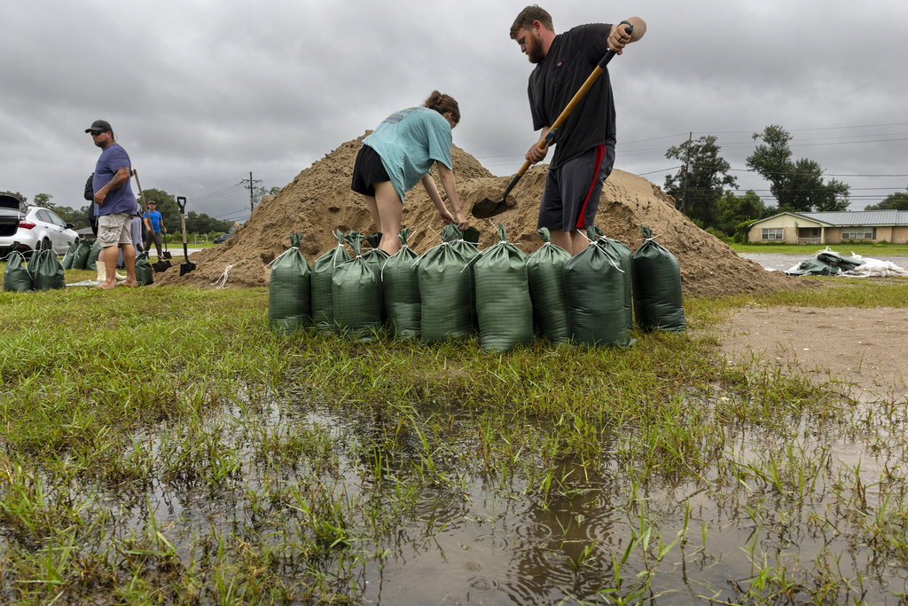
The Mississippi Emergency Management Agency said it distributed more than 100,000 sandbags to the southern part of the state and the Department of Education reported a number of school district closures for Wednesday and Thursday.
Bands of heavy rain were hitting New Orleans Wednesday morning. The city’s historic streetcars that roll on South Carrollton Avenue had to ease past cars that motorists parked next to the tracks on the grassy median. The median is a few inches higher than the street and drivers sometimes park there to avoid street flooding.
Francine is the sixth named storm of the Atlantic hurricane season. Much of Louisiana and Mississippi could get 4 to 8 inches (10 to 20 centimeters) of rain, with the possibility of 12 inches (30 centimeters) in some spots, Brad Reinhart, a senior hurricane specialist at the hurricane center.
The hurricane center said parts of Mississippi, Alabama and the Florida Panhandle were at risk of “considerable” flash and urban flooding starting Wednesday. The lower Mississippi Valley and lower Tennessee Valley could experience flooding later in the week as the soggy remnants of Francine sweep inland.
Francine’s storm surge on the Louisiana coast could reach as much as 10 feet (3 meters) from Cameron to Port Fourchon and into Vermilion Bay, forecasters said. They said landfall was likely somewhere between Sabine Pass — on the Texas-Louisiana line — and Morgan City, about 220 miles (350 kilometers) to the east.
___
Cline reported from Baton Rouge, Louisiana. Associated Press writers Curt Anderson in St. Petersburg, Florida, and Kevin McGill in New Orleans contributed to this story.


